Thursday, October 23, 2014

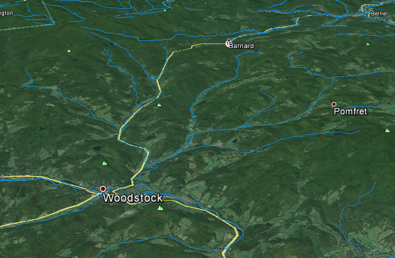
Vermont and New Hampshire Rivers and Lakes in Google Earth


National Hydrological Dataset (NHD) Google Earth layers for Vermont and New Hampshire

Download:
Vermont and New Hampshire NHD Google Earth Layers

There are three files:
  1. Named Streams
  2. Named Waterbodies
  3. Unnamed Streams (this one is big)


Tuesday, October 21, 2014

SfM Fly Throughs

Two new flythroughs from some recent work. The first is all in 3D (red/cyan anaglyph) and is a recent talk I gave as part of the 2014 Neukom Institute Dinner. The second is from some recent work in Massachusetts, the first half of the video is 2D and the second-half (jump to 2:08) is in 3D.

I would definitely recommend viewing full screen. Double-check to make sure the resolution is set to 1080. Depending on your browser you may need to click the YouTube button to "Watch on YouTube.com" to be able to get to full screen.

The data for these were produced with Agisoft Photoscan Pro and the fly throughs were made with Bentley Pointools.

Monday, October 6, 2014

Camera Geometries for SfM - UPDATE

This is a quick update for my original camera geometry post.

Based on work by Mike James and Stuart Robson (Link) and some of my own research it has become apparent that strictly parallel camera geometries produce some interesting distortions in some SFM reconstructions. The parallel nature can cause systematic distortions in final point clouds, DEMs, etc...

Therefore, it is good practice to not limit yourself to one specific geometry. Convergent geometries seem to work the best in most situations. A variety of camera heights also seem to improve things and helps add to the convergent geometry. My suggestion is to play around with different geometries in an area that's analogous to your study area to get a feel for what type of pattern will work best and be efficient.