Monday, October 16, 2017

Filtering LiDAR data by height above ground

For this tutorial we will be using CloudCompare (version 2.8, cloudcompare.org)

Lidar point clouds normally come with elevations above sea level (or some other datum), which is 
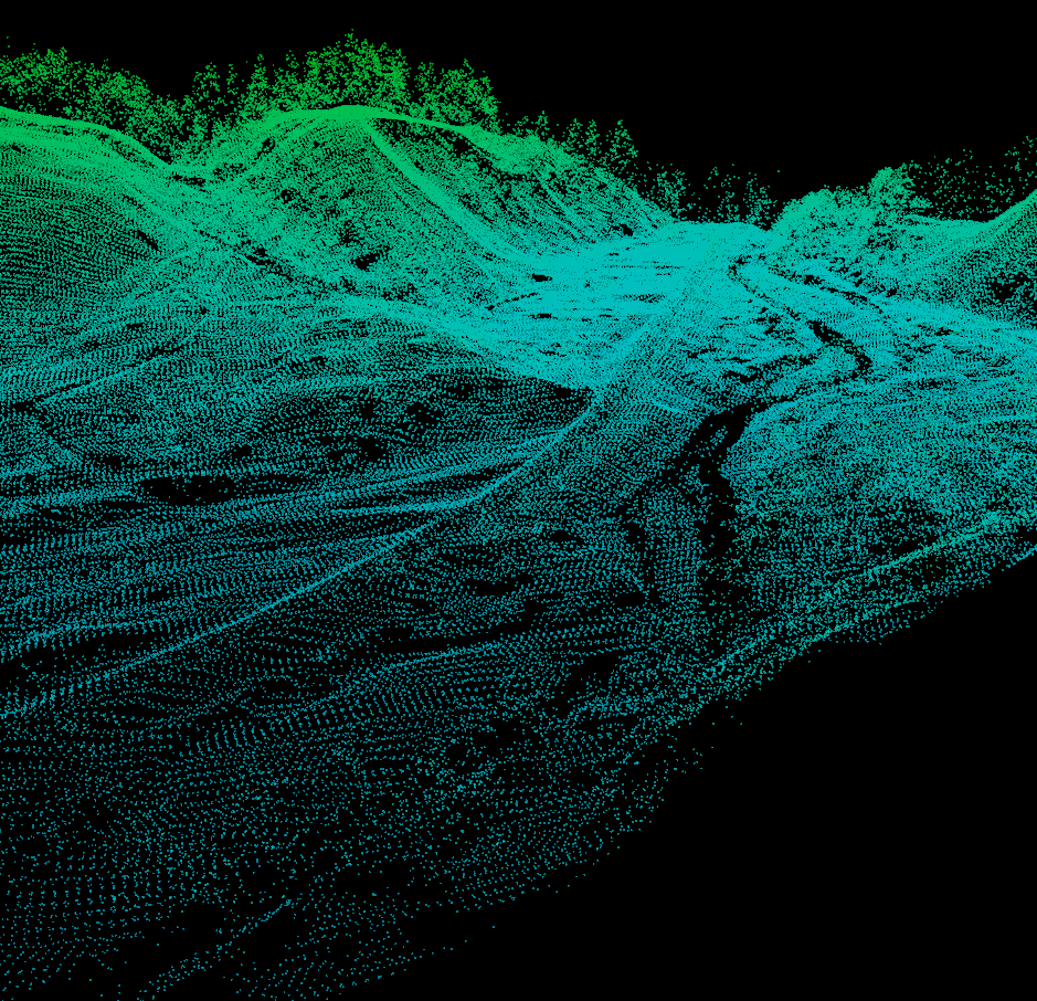
extremely useful. However, we can convert the Z-values into a height above the ground as way to add another layer of data so that we can measure things like average tree heights, examine building heights., or (one thing I do a lot) filter the points to so that we only see points in a specific height range above the ground. This last application is what we'll be covered here and it's really useful to examine river channels below dense vegetation.

Wednesday, June 28, 2017

New Job!!!

This summer I'll be transitioning away from Dartmouth to a tenure-track position in the Geography Department at the University of Northern Iowa.

I've updated my contact info on my About Me page.

Tuesday, October 4, 2016

New Articles

Here are two recent articles that I was working on over the summer, both in Earth Surface Processes and Landforms. Enjoy!

Dietrich, J. T. (2016) Bathymetric Structure from Motion: Extracting shallow stream bathymetry from multi-view stereo photogrammetry. Earth Surface Processes and Landforms, doi: 10.1002/esp.4060.
http://onlinelibrary.wiley.com/doi/10.1002/esp.4060/abstract

Carbonneau, P. E., and Dietrich, J. T. (2016) Cost-effective non-metric photogrammetry from consumer-grade sUAS: implications for direct georeferencing of structure from motion photogrammetry. Earth Surface Processes and Landforms, doi: 10.1002/esp.4012.
http://onlinelibrary.wiley.com/wol1/doi/10.1002/esp.4012/abstract


Friday, August 26, 2016

New Off Nadir Resolution Calculator

A quick update, I uploaded a new Python off-nadir resolution calculator to my GitHub:

https://github.com/geojames/py_offNadir_Res

It only works for low-oblique images (theoretically it would also work for nadir images if you set the pitch of the camera to zero). It calculates the pixel resolutions for the near field (closest to the camera), mid field (at the principal point), and the far field (furthest for the camera). It will also tell you the area that each image covers.

If your interested in how it works head over to the GitHub repository.

Tuesday, January 12, 2016

Amethyst Brook Dam Removal

Some footage from last week's dam removal on a stream that we (Dartmouth) have been doing extensive monitoring on in West-central Massachusetts (near Amherst).


More photos of the site post-removal are here: https://goo.gl/photos/xxTxe34HzTcnPozr8 (some are thanks to Alex Hackman of Mass. Fish and Game)

Friday, December 4, 2015

GIS Change Detection Math

I do a lot of topographic\geomorphic change detection, mostly with raster digital elevation models but I've also started getting into point cloud differencing too. It's simple subtraction, but the way you do your subtraction can make a big difference in how you interpret the data. I've had several students ask about this, so I thought a short write up was in order. The examples here are topographic (erosion and deposition), but the concepts apply to any raster-based change detection (i.e. land use/land cover change).

Tuesday, August 18, 2015

Calculating Spatial Resolutions for Aerial Imagery

I've often needed to calculate/predict the spatial resolution for aerial imagery collections that I do (the life of a remote sensing researcher). I wrote a Matlab script for some helicopter aerial photography as part of my dissertation research. But, I needed a more streamlined script for some of my current work with UAVs. So, here is a brand new Python script to do all the calculations for me (and you).

Thursday, July 30, 2015

Strapping a NIR Camera onto the Inspire 1

I finally went and did it...strapped my near-infrared camera (NIR) onto our DJI Inspire 1. Here are some of the results from this quick test flight.

For those unfamiliar with NIR imaging, in Geography we primarily use the near-infrared portion of the spectrum to help us measure a multitude of things just beyond the visible portion of the electromagnetic spectrum. Some of the primary uses for NIR imaging are to measure vegetation types, vegetation health, and help differentiate different landuse/landcover types. Here's a NASA link to more information on NIR and another on the Normalized Difference Vegetation Index (results below).

Wednesday, June 24, 2015

Agisoft Photoscan Crash Course (updated for version 1.1.6)

Finally, time for an update…this time to Photoscan Professional 1.1.6. In this tutorial, I am going to fly through the basics of getting a Photoscan project up and running without getting to deep into the details. If you are interested in the details of specific tools, I will refer you to the official documentation (Agisoft Photocan User Manuals).

The instructions for the previous version 1.0 are still here…
I also have discussions on cameras and camera geometry.

Friday, May 8, 2015

Raspberry Pi Camera Extension Cable

I'm working on a project (hopefully to be completed this summer) that needed a longer, less rigid camera cable for my Pi camera board. I thought I would document this part of the project separately since it might be useful to others.

Friday, May 1, 2015

Desktop SfM Background and Scale

It seems like I've been doing/helping out with a lot of "desktop" structure-from-motion modeling. Through various iterations and attempts to scale the final SfM point clouds, the Van Gogh scale has emerged. So, I thought I'd share it in the hope that others can get some use out of it.

Wednesday, March 18, 2015

Maiden flight of our new UAV

A quick video of the maiden flight of our new DJI Inspire 1 quadcopter. We (the Dartmouth fluvial research group) will be using it this summer to do aerial surveys of several rivers throughout New England to look at dam removals, storm damage/recovery, and I'm sure much more.


Tuesday, December 23, 2014

New Pages: Software and Publications

Now that I'm down with my dissertation, it's time to make some improvements...I've added two new pages to my site: Publications and Software. I'll be updating these periodically with my pubs and some of the software/code that's floating around.

Both of these new pages have been added to the navigation tabs at the top of the page.

Enjoy!

Thursday, December 4, 2014

LiDAR datum transformations

A stretch of the Roaring Branch of the Walloomsac River near Bennington, VT. So, I've been helping get an Earth Science graduate student going on some change detection work with some lidar data from the State of Vermont. As we were going through some of the sample datasets an interesting, yet not surprising, realization came over us...several of the datasets were in different projections. So we set out to find a simple way to convert the raw LAS files from lovely Vermont State Plane coordinates in feet (both horizontal and vertical) to the infinitely useful UTM with meters all around.

There are several options out there, but I rediscovered an old standby, the National Geodetic Survey's VDATUM tool.

Tuesday, November 25, 2014

Online Point Cloud Viewer (Finally!!!)

I finally found what I been wanted since I started collecting 3D datasets 4-ish years ago, an efficient online point cloud viewer!

The viewer is by Markus Schütz over at potree.org. It only took a little while to get the code up and running.


Thursday, October 23, 2014

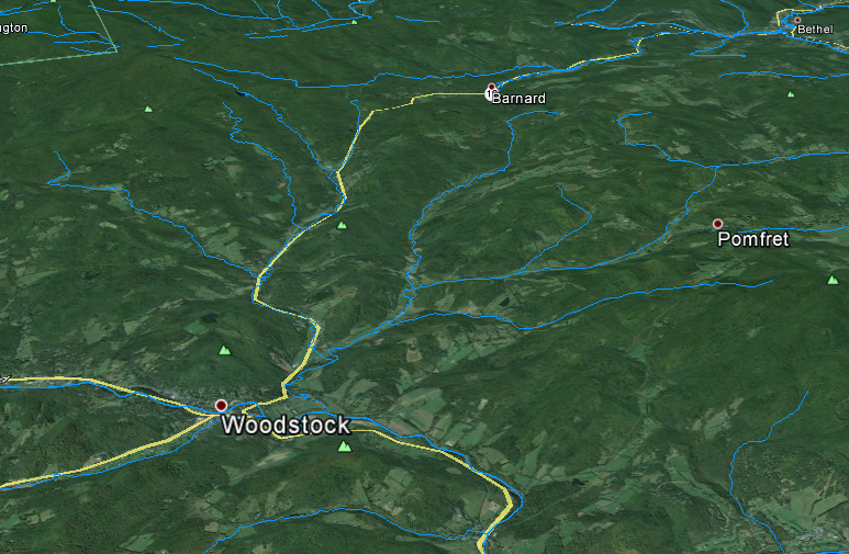
Vermont and New Hampshire Rivers and Lakes in Google Earth


National Hydrological Dataset (NHD) Google Earth layers for Vermont and New Hampshire

Download:
Vermont and New Hampshire NHD Google Earth Layers

There are three files:
  1. Named Streams
  2. Named Waterbodies
  3. Unnamed Streams (this one is big)


Tuesday, October 21, 2014

SfM Fly Throughs

Two new flythroughs from some recent work. The first is all in 3D (red/cyan anaglyph) and is a recent talk I gave as part of the 2014 Neukom Institute Dinner. The second is from some recent work in Massachusetts, the first half of the video is 2D and the second-half (jump to 2:08) is in 3D.

I would definitely recommend viewing full screen. Double-check to make sure the resolution is set to 1080. Depending on your browser you may need to click the YouTube button to "Watch on YouTube.com" to be able to get to full screen.

The data for these were produced with Agisoft Photoscan Pro and the fly throughs were made with Bentley Pointools.

Monday, October 6, 2014

Camera Geometries for SfM - UPDATE

This is a quick update for my original camera geometry post.

Based on work by Mike James and Stuart Robson (Link) and some of my own research it has become apparent that strictly parallel camera geometries produce some interesting distortions in some SFM reconstructions. The parallel nature can cause systematic distortions in final point clouds, DEMs, etc...

Therefore, it is good practice to not limit yourself to one specific geometry. Convergent geometries seem to work the best in most situations. A variety of camera heights also seem to improve things and helps add to the convergent geometry. My suggestion is to play around with different geometries in an area that's analogous to your study area to get a feel for what type of pattern will work best and be efficient.

Sunday, July 27, 2014

Helikite Test Flight

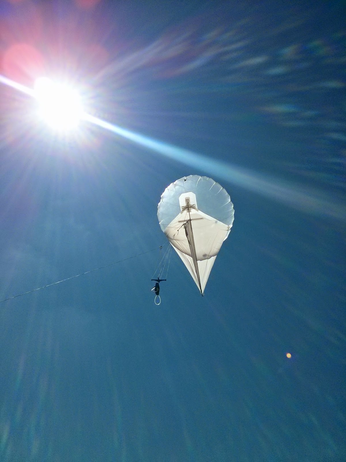
We took out the new Helikite for a test run before it heads out into the field to do some real work. Nothing fancy just a new 3D printed picevet (Chris Fastie's design), and a few natural color images with a Canon A3300 and a few near IR photos with a modified Canon A480.

Friday, July 18, 2014

Heading to Dartmouth

As some of you know I headed to Dartmouth College at the end of the month to start "life after grad school" with a two-year appointment as a postdoctoral fellow in the William H. Neukom Institute for Computational Science. I've updated my contact info on this site. My Univ. of Oregon email will still work for a while but don't be surprised if you hear back from my Dartmouth account.