Showing posts with label 3D. Show all posts

Monday, October 16, 2017

Filtering LiDAR data by height above ground

For this tutorial we will be using CloudCompare (version 2.8, cloudcompare.org)

Lidar point clouds normally come with elevations above sea level (or some other datum), which is 
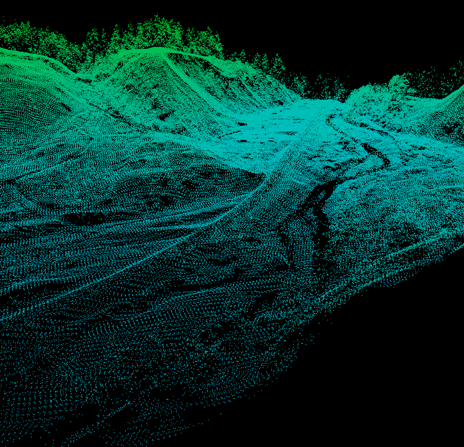
extremely useful. However, we can convert the Z-values into a height above the ground as way to add another layer of data so that we can measure things like average tree heights, examine building heights., or (one thing I do a lot) filter the points to so that we only see points in a specific height range above the ground. This last application is what we'll be covered here and it's really useful to examine river channels below dense vegetation.

Tuesday, January 12, 2016

Amethyst Brook Dam Removal

Some footage from last week's dam removal on a stream that we (Dartmouth) have been doing extensive monitoring on in West-central Massachusetts (near Amherst).


More photos of the site post-removal are here: https://goo.gl/photos/xxTxe34HzTcnPozr8 (some are thanks to Alex Hackman of Mass. Fish and Game)

Thursday, July 30, 2015

Strapping a NIR Camera onto the Inspire 1

I finally went and did it...strapped my near-infrared camera (NIR) onto our DJI Inspire 1. Here are some of the results from this quick test flight.

For those unfamiliar with NIR imaging, in Geography we primarily use the near-infrared portion of the spectrum to help us measure a multitude of things just beyond the visible portion of the electromagnetic spectrum. Some of the primary uses for NIR imaging are to measure vegetation types, vegetation health, and help differentiate different landuse/landcover types. Here's a NASA link to more information on NIR and another on the Normalized Difference Vegetation Index (results below).

Wednesday, June 24, 2015

Agisoft Photoscan Crash Course (updated for version 1.1.6)

Finally, time for an update…this time to Photoscan Professional 1.1.6. In this tutorial, I am going to fly through the basics of getting a Photoscan project up and running without getting to deep into the details. If you are interested in the details of specific tools, I will refer you to the official documentation (Agisoft Photocan User Manuals).

The instructions for the previous version 1.0 are still here…
I also have discussions on cameras and camera geometry.

Thursday, December 4, 2014

LiDAR datum transformations

A stretch of the Roaring Branch of the Walloomsac River near Bennington, VT. So, I've been helping get an Earth Science graduate student going on some change detection work with some lidar data from the State of Vermont. As we were going through some of the sample datasets an interesting, yet not surprising, realization came over us...several of the datasets were in different projections. So we set out to find a simple way to convert the raw LAS files from lovely Vermont State Plane coordinates in feet (both horizontal and vertical) to the infinitely useful UTM with meters all around.

There are several options out there, but I rediscovered an old standby, the National Geodetic Survey's VDATUM tool.

Tuesday, November 25, 2014

Online Point Cloud Viewer (Finally!!!)

I finally found what I been wanted since I started collecting 3D datasets 4-ish years ago, an efficient online point cloud viewer!

The viewer is by Markus Schütz over at potree.org. It only took a little while to get the code up and running.


Tuesday, October 21, 2014

SfM Fly Throughs

Two new flythroughs from some recent work. The first is all in 3D (red/cyan anaglyph) and is a recent talk I gave as part of the 2014 Neukom Institute Dinner. The second is from some recent work in Massachusetts, the first half of the video is 2D and the second-half (jump to 2:08) is in 3D.

I would definitely recommend viewing full screen. Double-check to make sure the resolution is set to 1080. Depending on your browser you may need to click the YouTube button to "Watch on YouTube.com" to be able to get to full screen.

The data for these were produced with Agisoft Photoscan Pro and the fly throughs were made with Bentley Pointools.

Tuesday, December 17, 2013

Mobile LiDAR / Point Cloud Veiwer

Cover art
Just a quick post on something I found just in time for AGU, a mobile LiDAR / Point Cloud viewer app for Android (Google Play). I've been searching for an app like this since I started creating 3D datasets.


It works best with LAS files, which for Structure-from-Motion point cloud data you can export LAS files from CloudCompare. It seemed to have a problem with UTM coordinates (probably to a decimal precision cut off), but if you export the data in a "local" coordinate system it works beautifully. I also tried it on some OpenTopography LiDAR data and it works just fine.


Friday, November 1, 2013

Kinect Field Mapping Trial

Just a quick demo of field mapping with a Microsoft Kinect. We set out to test the Kinect outdoors. Luckily, Scott Creek is under a wonderful canopy of Cascade forest, which was good for the Kinect's infrared depth sensor. Check out the video of collecting and processing the data in the field and below is an interactive 3D point cloud. We used Faro Scenect to collect and process the Kinect data. More to come on this later...

Tuesday, October 29, 2013

Converting DEMs to STL files for 3D printing

Ever since we got a 3D printer in the Geography Department at the University of Oregon, we've wanted to print out topographic models. Thingaverse user Markus Fussenegger (mfussi) has a nice compact Java program, Heightmap to STL, for converting height map images into STL files for 3D printing. Markus's program is available on Sourceforge through Thingaverse (http://www.thingiverse.com/thing:15276).

This is just a quick tutorial on how I got his code up and running on my Windows 7 machine...

Sunday, September 29, 2013

Helicopter Aerial Photography

Just finished collecting data for the last part of my dissertation (Hooray!!!). Just thought I'd share some of the results. The photos were processed with Agisoft Photoscan Pro and the orthophotos ended up with a resolution of 5cm (which is exactly what I wanted). Great first results and special thanks to Mark Croghan at the Bureau of Reclamation for the funding and Troy Woydziak at Baker Aircraft for his great piloting.

Friday, March 8, 2013

Kinect Software Links

Here is some of the software I've tried out for getting data out of a stock XBOX 360 Kinect. There is a ton of info out there on hacking the Kinect to do your bidding in terms of 3D scanning.
SCANECT
RGB Demo
SCENECT

All of these use the OpenNI drivers for the Kinect

Bonus...some academic lit. on using the connect as a sensor
by Ken Mankoff in Earth Surface Processes and Landforms
The Kinect: a low-cost, high-resolution, short-range 3D camera
- http://onlinelibrary.wiley.com/doi/10.1002/esp.3332/abstract

Updated SfM Software Links

My original post on SfM software is here.

There are a growing number of Structure-from-Motion (SfM) software packages out there, here are some of the ones that I've come in contact with. VisualSfM would be the place I would start...

Tuesday, June 26, 2012

3D Coordinate Transformations

JAG3D is a large software package that can be used for geodetic correction of survey data, however, buried within the interface is a nice compact module for performing full 3D coordinate transformations.


This tutorial is for JAG3D version 3.3.20110211 (published Feb. 11, 2011)

Data Prep for JAG3D

Instructions for preparing your Photosynth data for JAG3D Transformation.

Photosynth Software Links

A collection of software links to help with processing Photosynth data.