Showing posts with label SfM. Show all posts

Tuesday, October 4, 2016

New Articles

Here are two recent articles that I was working on over the summer, both in Earth Surface Processes and Landforms. Enjoy!

Dietrich, J. T. (2016) Bathymetric Structure from Motion: Extracting shallow stream bathymetry from multi-view stereo photogrammetry. Earth Surface Processes and Landforms, doi: 10.1002/esp.4060.
http://onlinelibrary.wiley.com/doi/10.1002/esp.4060/abstract

Carbonneau, P. E., and Dietrich, J. T. (2016) Cost-effective non-metric photogrammetry from consumer-grade sUAS: implications for direct georeferencing of structure from motion photogrammetry. Earth Surface Processes and Landforms, doi: 10.1002/esp.4012.
http://onlinelibrary.wiley.com/wol1/doi/10.1002/esp.4012/abstract


Tuesday, January 12, 2016

Amethyst Brook Dam Removal

Some footage from last week's dam removal on a stream that we (Dartmouth) have been doing extensive monitoring on in West-central Massachusetts (near Amherst).


More photos of the site post-removal are here: https://goo.gl/photos/xxTxe34HzTcnPozr8 (some are thanks to Alex Hackman of Mass. Fish and Game)

Tuesday, August 18, 2015

Calculating Spatial Resolutions for Aerial Imagery

I've often needed to calculate/predict the spatial resolution for aerial imagery collections that I do (the life of a remote sensing researcher). I wrote a Matlab script for some helicopter aerial photography as part of my dissertation research. But, I needed a more streamlined script for some of my current work with UAVs. So, here is a brand new Python script to do all the calculations for me (and you).

Thursday, July 30, 2015

Strapping a NIR Camera onto the Inspire 1

I finally went and did it...strapped my near-infrared camera (NIR) onto our DJI Inspire 1. Here are some of the results from this quick test flight.

For those unfamiliar with NIR imaging, in Geography we primarily use the near-infrared portion of the spectrum to help us measure a multitude of things just beyond the visible portion of the electromagnetic spectrum. Some of the primary uses for NIR imaging are to measure vegetation types, vegetation health, and help differentiate different landuse/landcover types. Here's a NASA link to more information on NIR and another on the Normalized Difference Vegetation Index (results below).

Wednesday, June 24, 2015

Agisoft Photoscan Crash Course (updated for version 1.1.6)

Finally, time for an update…this time to Photoscan Professional 1.1.6. In this tutorial, I am going to fly through the basics of getting a Photoscan project up and running without getting to deep into the details. If you are interested in the details of specific tools, I will refer you to the official documentation (Agisoft Photocan User Manuals).

The instructions for the previous version 1.0 are still here…
I also have discussions on cameras and camera geometry.

Friday, May 1, 2015

Desktop SfM Background and Scale

It seems like I've been doing/helping out with a lot of "desktop" structure-from-motion modeling. Through various iterations and attempts to scale the final SfM point clouds, the Van Gogh scale has emerged. So, I thought I'd share it in the hope that others can get some use out of it.

Wednesday, March 18, 2015

Maiden flight of our new UAV

A quick video of the maiden flight of our new DJI Inspire 1 quadcopter. We (the Dartmouth fluvial research group) will be using it this summer to do aerial surveys of several rivers throughout New England to look at dam removals, storm damage/recovery, and I'm sure much more.


Tuesday, November 25, 2014

Online Point Cloud Viewer (Finally!!!)

I finally found what I been wanted since I started collecting 3D datasets 4-ish years ago, an efficient online point cloud viewer!

The viewer is by Markus Schütz over at potree.org. It only took a little while to get the code up and running.


Tuesday, October 21, 2014

SfM Fly Throughs

Two new flythroughs from some recent work. The first is all in 3D (red/cyan anaglyph) and is a recent talk I gave as part of the 2014 Neukom Institute Dinner. The second is from some recent work in Massachusetts, the first half of the video is 2D and the second-half (jump to 2:08) is in 3D.

I would definitely recommend viewing full screen. Double-check to make sure the resolution is set to 1080. Depending on your browser you may need to click the YouTube button to "Watch on YouTube.com" to be able to get to full screen.

The data for these were produced with Agisoft Photoscan Pro and the fly throughs were made with Bentley Pointools.

Monday, October 6, 2014

Camera Geometries for SfM - UPDATE

This is a quick update for my original camera geometry post.

Based on work by Mike James and Stuart Robson (Link) and some of my own research it has become apparent that strictly parallel camera geometries produce some interesting distortions in some SFM reconstructions. The parallel nature can cause systematic distortions in final point clouds, DEMs, etc...

Therefore, it is good practice to not limit yourself to one specific geometry. Convergent geometries seem to work the best in most situations. A variety of camera heights also seem to improve things and helps add to the convergent geometry. My suggestion is to play around with different geometries in an area that's analogous to your study area to get a feel for what type of pattern will work best and be efficient.

Sunday, July 27, 2014

Helikite Test Flight

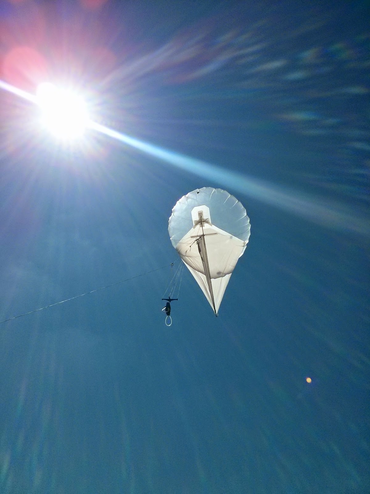
We took out the new Helikite for a test run before it heads out into the field to do some real work. Nothing fancy just a new 3D printed picevet (Chris Fastie's design), and a few natural color images with a Canon A3300 and a few near IR photos with a modified Canon A480.

Friday, April 4, 2014

AAG 2014

Sub-Meter Remote Sensing for Fluvial Monitoring with Off-the-Shelf Components
James T. Dietrich University of Oregon, Department of Geography
Session: 1224 - River Observations, Monitoring, and Management
Tuesday, 4/8/2014, from 10:00 AM - 11:40 AM

DOWNLOAD


Friday, March 21, 2014

Agisoft Photoscan Crash Course (v. 1.0.2)

*Updated version for Photoscan 1.1 is finally here*


A not-so-quick tutorial in using Photoscan to process a single photoset in Agisoft Photoscan Professional version 1.0 (1.0.2 or 1.0.3), for Photoscan version 1.1 please see the updated tutorial.

I have written this for various research groups at the University of Oregon, Oregon State University, and Dartmouth College. I hope that this will help others get started as well. I also plan to add screen shots to this eventually, but for now this will have to do.

Thursday, February 6, 2014

Camera geometries for Structure-from-Motion mapping

UPDATE POSTED - HERE

Camera geometry, the way photographs overlap, is an important factor in successful mapping when using Structure-from-Motion (SfM). There are several main geometries that photosets fall into: divergent, convergent, parallel, and whether the camera is pointed at a nadir or oblique angles. The type of geometry you use is dependent on the research question and there is always going to be some natural variation in a photoset but you should attempt to keep a consistent overall geometry in the scene. These are simply guidelines, one of the beautiful things about SfM is that is can be forgiving, so if you do not take perfectly aligned photos your 3D model will not be lost. Also, I cannot stress the important of practice. Before you head out for a full field campaign find an analog to your study site and practice taking photographs using the different camera geometry guidelines. This will help you plan for the field and also let you experiment with the processing workflow and familiarize yourself with how the software behaves.

Tuesday, January 14, 2014

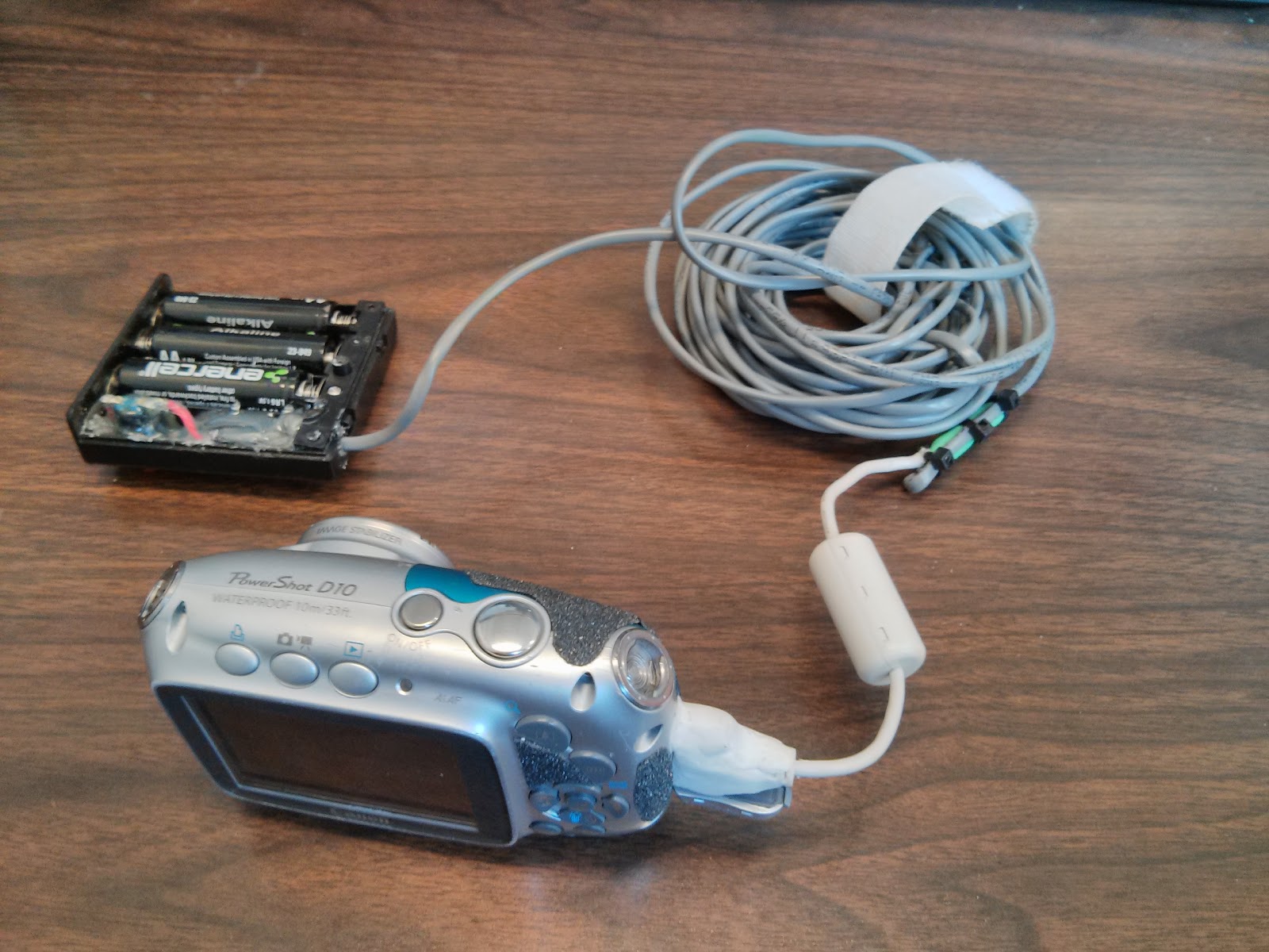
Wired CHDK Trigger for Pole Photography


As some of you may know, I use occasionally use pole photography for my research. Getting the camera on the pole is the easy part (Pole Camera), the hard part is getting it to take pictures while it's up there.


I use almost entirely Canon cameras and CHDK is such a wonderful add-on to the smaller cameras I use. One key thing CHDK allows you to do is use the USB port on the camera to trigger the camera. This post is a rehash of the basic remote trigger that CHDK has on their site (http://chdk.wikia.com/wiki/USB_Remote), but I thought I'd post my design if you're interested in building your own.

Tuesday, December 17, 2013

Mobile LiDAR / Point Cloud Veiwer

Cover art
Just a quick post on something I found just in time for AGU, a mobile LiDAR / Point Cloud viewer app for Android (Google Play). I've been searching for an app like this since I started creating 3D datasets.


It works best with LAS files, which for Structure-from-Motion point cloud data you can export LAS files from CloudCompare. It seemed to have a problem with UTM coordinates (probably to a decimal precision cut off), but if you export the data in a "local" coordinate system it works beautifully. I also tried it on some OpenTopography LiDAR data and it works just fine.


Thursday, November 28, 2013

AGU 2013

4D Monitoring of a River Restoration Project with Structure-from-Motion
James T. Dietrich, jdietric@uoregon.edu
University of Oregon, Department of Geography
Poster: EP43C-0865
  

This is just a reduced resolution preview, please use the link above to download the full poster.

Friday, October 11, 2013

Cameras for SfM

Camera choice for SfM is important...but maybe more important is taking the right photos. Taking the right photos is the subject of an upcoming post, but for now we'll just focus on cameras. I'll go over the setups we have running and also talk about some of the pitfalls of certain cameras.

Sunday, September 29, 2013

Helicopter Aerial Photography

Just finished collecting data for the last part of my dissertation (Hooray!!!). Just thought I'd share some of the results. The photos were processed with Agisoft Photoscan Pro and the orthophotos ended up with a resolution of 5cm (which is exactly what I wanted). Great first results and special thanks to Mark Croghan at the Bureau of Reclamation for the funding and Troy Woydziak at Baker Aircraft for his great piloting.

Friday, March 8, 2013

Updated SfM Software Links

My original post on SfM software is here.

There are a growing number of Structure-from-Motion (SfM) software packages out there, here are some of the ones that I've come in contact with. VisualSfM would be the place I would start...